Predicting abundances of invasive ragweed across Europe using a “top-down” approach
- Skjøth, Carsten Ambelas School of Science and the Environment, University of Worcester, Henwick Grove, WR2 6AJ Worcester, United Kingdom
- Sun, Yan Department of Biology/Ecology & Evolution, University of Fribourg, Switzerland
- Karrer, Gerhard Department of Integrative Biology and Biodiversity Research, University of Natural Resources and Life Sciences, Vienna, Austria
- Sikoparija, Branko BioSense Institute - Research Institute for Information Technologies in Biosystems, University of Novi Sad, Novi Sad, Serbia
- Smith, Matt School of Science and the Environment, University of Worcester, Henwick Grove, WR2 6AJ Worcester, United Kingdom
- Schaffner, Urs Centre for Agriculture and Biosciences International, Delémont, Switzerland
- Müller-Schärer, Heinz Department of Biology/Ecology & Evolution, University of Fribourg, Switzerland
-
10.10.2019
Published in:
- Science of The Total Environment. - 2019, vol. 686, p. 212–222
English
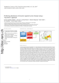
Common ragweed (Ambrosia artemisiifolia L.) is a widely distributed and harmful invasive plant that is an important source of highly allergenic pollen grains and a prominent crop weed. As a result, ragweed causes huge costs to both human health and agriculture in affected areas. Efficient mitigation requires accurate mapping of ragweed densities that, until now, has not been achieved accurately for the whole of Europe. Here we provide two inventories of common ragweed abundances with grid resolutions of 1 km and 10 km. These “top-down” inventories integrate pollen data from 349 stations in Europe with habitat and landscape management information, derived from land cover data and expert knowledge. This allows us to cover areas where surface observations are missing. Model results were validated using “bottom– up” data of common ragweed in Austria and Serbia. Results show high agreement between the two analytical methods. The inventory shows that areas with the lowest ragweed abundances are found in Northern and Southern European countries and the highest abundances are in parts of Russia, parts of Ukraine and the Pannonian Plain. Smaller hotspots are found in Northern Italy, the Rhône Valley in France and in Turkey. The top-down approach is based on a new approach that allows for cross- continental studies and is applicable to other anemophilous species. Due to its simplicity, it can be used to investigate such species that are difficult and costly to identify at larger scales using traditional vegetation surveys or remote sensing. The final inventory is open source and available as a georeferenced tif file, allowing for multiple usages, reducing costs for health services and agriculture through well- targeted management interventions.
- Faculty
- Faculté des sciences et de médecine
- Department
- Département de Biologie
- Language
-
- English
- Classification
- Biological sciences
- License
-
License undefined
- Identifiers
-
- RERO DOC 327374
- DOI 10.1016/j.scitotenv.2019.05.215
- Persistent URL
- https://folia.unifr.ch/unifr/documents/308074
Statistics
Document views: 140
File downloads:
- pdf: 340
